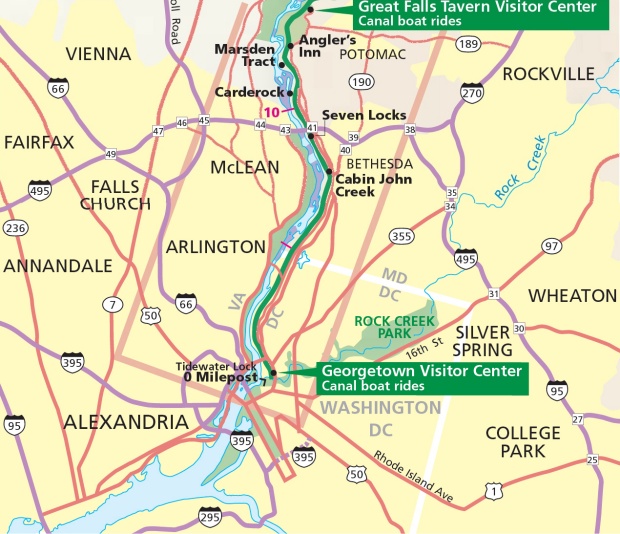
Chesapeake & Ohio Canal National Historic Park
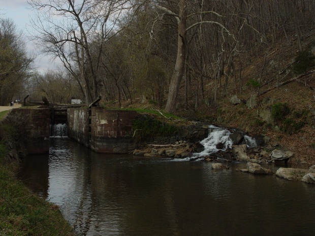
From Rock Creek Parkway on the west side of Washington proper, the Chesapeake & Ohio Canal runs through Georgetown, and further west through the District of Columbia, and further west through Maryland north of the Potomac River to the crest of the rocky falls of that great river resides the C & O Canal National Historic Park. This National Historic Park is located at the locale of the "6 Locks at Great Falls." Within the boundaries of the park are the 6 locks (each lock raises or lowers the boat approximately 8'), as well as the renovate lock keeper's house.
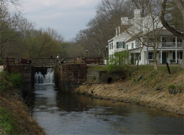
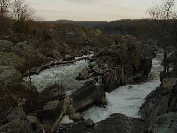
Why are there 6 locks and a lock keeper's house in the C & O Canal National Historic Park? Well if you consider the ragged rocks and inconsistent water levels of The Great Falls of the Potomac one can understand that they had to be avoided at great cost, so that trade and future settlements could be established beyond the western ridge of the Allegheny Mountains: a land known, at that time, as the Ohio Valley. That is why, at this point in the lower waters of the Chesapeake and Ohio Canal, that this one lane canal was built in the side of these hard granite hills, with 6 locks to help the navigation of grade as these slender canal boats headed north and west into the foothills of the Appalachian Mountains.
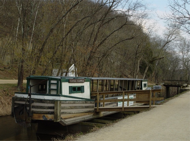
While this project has always been the stepchild of George Washington, it was President John Quincy Adams who turned the first spade of dirt to initiate the project on July 4, 1828. The C & O Canal began that summer just west of the renovated Whitehouse and continued 185 miles north and west to its completion at Cumberland, Maryland in 1850. The canal proved too expensive at over 11 million dollars, but was an invaluable tool in moving people and supplies safely west across some very rugged terrain.
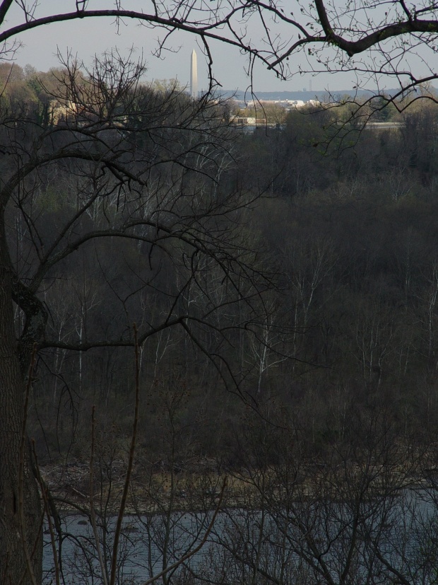
The day my son and I visited the National Historic Park, he had just one day earlier graduated from the U.S. Coast Guard’s basic training class in Cape May, N.J. It was late March, and while the days were getting longer, we had just about spent this one when we got to the park. We had time to walk the trails down to the surprisingly ragged Potomac River to The Great Falls. Just 14 miles from the Arlington Memorial Bridge and the Potomac had gone from the muck of the “tidal basin” between The Mall to the Thomas Jefferson Memorial to a rocky mountain rapids.
My son and I were visiting the area near the Thomas Jefferson Memorial and the veritable hordes were so great, we found our way to the Arlington Memorial, across the Potomac to the southern shore of the Potomac River and then west on the George Washington Memorial Parkway (very scenic route). It was such a nice drive and along the way, my son, who was looking at my map, suggested that we visit the National Historic site. Why? No good reason. It was just a place that neither of us had ever been. The scenic ride along the parkway was an unexpected treat.
As I drove to the park, my son remarked just how tall the hills were becoming, especially as we headed north across the Potomac into Maryland. The homes were large and appeared architecturally significant, at least by the standards of this era. Once inside the park, and with a limited amount of time, we walked fast and I shot what photographs that I could. We did not have time to visit the Great Falls Tavern Visitor Center. We did; however, sojourn down the rocky trails to the Great Falls, and to our amazement, saw some geography that was more reminiscent of the Shenandoah than the Chesapeake.
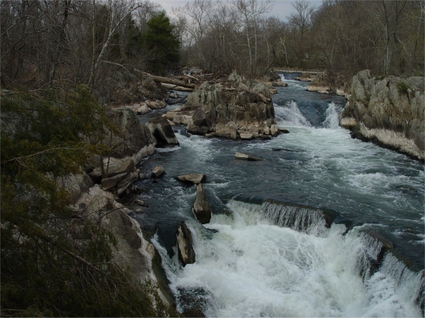
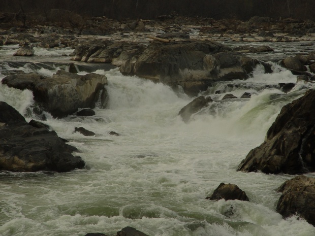
Along the rocky shores of the exposed granite boulders were whitetail deer watering as the sun began to sink in the southwestern sky. After seeing the enormity of these granite stones and hearing the power of the rushing river, I could well understand the necessity of the C & O Canal traversing the Potomac in those days before the inception of travel by rail. Across the rapids of this rocky river is situated the Great Falls National Park, that is over 800 acres, with many miles of trails traversing the hilly Virginia shore.
This article provided courtesy of our sister site:
Better Travelers Now.


