
A Constitutional Republic, where the First Amendment is Essential to OUR Survival


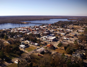


Nor’easter Bearing Down on Eastern North Carolina, Revised


News release: (Afternoon 112613)
Good Afternoon:
The storm continues to strengthen and after a brief conversation with the NWS I have the following update. The briefing from this morning is still valid with two extensions of interest for us: They have extended through 9:00am tomorrow morning the slight risk of severe storms and we can expect sustained winds near 20mph with gust to just over 30mph possible through 10:00am and then both very gradually tapering through Thursday morning.
Please remember we will still have winds throughout the day on Thursday with wind chill values after dark in the 25 degree range by midnight.
Please stay weather aware and if you are driving to work in the morning use caution and watch for downed limbs and small trees on the road ways.
John Pack
Coordinator, Beaufort County Emergency Services
1420 Highland Drive
Washington, NC 27889
(252)946-2046 Office • (252) 975-6802 Fax • john.pack@co.beaufort.nc.us
News release: (Morning 112613)
Good Morning to All:
I have attached the NWS Weather Advisory I just received. This storm is already producing Ice, Sleet and Snow in the Mountains of our state. The briefing is very clear about our possible weather conditions. I do not to clarify some points so you will have the necessary information to make sound travel decisions if they involve travel tonight.
The main part of this Nor'easter like storm will impact us from about 7:00pm tonight through 7:00am tomorrow morning. That is when we will have the greatest threat for high wind gust, heavy rain and a possible tornado, yes I said tornado or storms that produce winds in excess of 60mph gust or straight line winds. It is possible there will be power outages in some areas of the County and there definitely could be limbs and small trees laying on our road ways. Please use caution when traveling this evening or early tomorrow morning. Please remember to take precautions to ensure the safety of your pets and domestic animals during these events. Please ensure all of these four legged friends have adequate identification tags on them should they become separated from your care.
First Responders, please take all necessary appropriate driving precautions during this time period. There will be some periods of rain on Wednesday and temperatures will begin to drop as the front passes. Cold Temperatures and even colder wind chills will be seen Wednesday evening and throughout the remainder of the week. As is always the case with Nor'easters some flooding of roads could take place along the water's edge anywhere in the County.
Travel with caution and keep an ear to your weather radios and First Responders please report all power outages and road hazards as appropriate through normal channels.
I will provide more updates as they become available.
Thank You for your service to the citizens of Beaufort County.
John Pack
Coordinator, Beaufort County Emergency Services
1420 Highland Drive
Washington, NC 27889
(252)946-2046 Office • (252) 975-6802 Fax • john.pack@co.beaufort.nc.us
Go Back
Good Afternoon:
The storm continues to strengthen and after a brief conversation with the NWS I have the following update. The briefing from this morning is still valid with two extensions of interest for us: They have extended through 9:00am tomorrow morning the slight risk of severe storms and we can expect sustained winds near 20mph with gust to just over 30mph possible through 10:00am and then both very gradually tapering through Thursday morning.
Please remember we will still have winds throughout the day on Thursday with wind chill values after dark in the 25 degree range by midnight.
Please stay weather aware and if you are driving to work in the morning use caution and watch for downed limbs and small trees on the road ways.
John Pack
Coordinator, Beaufort County Emergency Services
1420 Highland Drive
Washington, NC 27889
(252)946-2046 Office • (252) 975-6802 Fax • john.pack@co.beaufort.nc.us
News release: (Morning 112613)
Good Morning to All:
I have attached the NWS Weather Advisory I just received. This storm is already producing Ice, Sleet and Snow in the Mountains of our state. The briefing is very clear about our possible weather conditions. I do not to clarify some points so you will have the necessary information to make sound travel decisions if they involve travel tonight.
The main part of this Nor'easter like storm will impact us from about 7:00pm tonight through 7:00am tomorrow morning. That is when we will have the greatest threat for high wind gust, heavy rain and a possible tornado, yes I said tornado or storms that produce winds in excess of 60mph gust or straight line winds. It is possible there will be power outages in some areas of the County and there definitely could be limbs and small trees laying on our road ways. Please use caution when traveling this evening or early tomorrow morning. Please remember to take precautions to ensure the safety of your pets and domestic animals during these events. Please ensure all of these four legged friends have adequate identification tags on them should they become separated from your care.
First Responders, please take all necessary appropriate driving precautions during this time period. There will be some periods of rain on Wednesday and temperatures will begin to drop as the front passes. Cold Temperatures and even colder wind chills will be seen Wednesday evening and throughout the remainder of the week. As is always the case with Nor'easters some flooding of roads could take place along the water's edge anywhere in the County.
Travel with caution and keep an ear to your weather radios and First Responders please report all power outages and road hazards as appropriate through normal channels.
I will provide more updates as they become available.
Thank You for your service to the citizens of Beaufort County.
John Pack
Coordinator, Beaufort County Emergency Services
1420 Highland Drive
Washington, NC 27889
(252)946-2046 Office • (252) 975-6802 Fax • john.pack@co.beaufort.nc.us

| Nor’easter Bearing Down on Eastern North Carolina | Public Issues, Government, Governing Beaufort County | Fourth Circuit upholds multi-million dollar award in Taser death |

Latest Governing Beaufort County
 |
North Carolina's Rate Bureau has requested for 2024 an annual increase of 42.2%, whereby North Carolina's Insurance Commissioner Mike Causey has exhibited a great willingness to take a firm stand against such an exorbitant increase.
Published: Sunday, March 3rd, 2024 @ 3:06 pm
By: Stan Deatherage
|
 |
I reckon one could always argue that ignorance rests in the eyes of the beholder, but, I'm not taking that bet ... not in these Orwellian times, when so few of our fellow travelers know so little of what is real, and far too much of what otherwise might be terminally fake.
Published: Monday, February 12th, 2024 @ 9:02 am
By: Stan Deatherage
|
 |
There were numerous local professional and educational opportunities showcased on Wednesday at the Beaufort County Job and Resource Fair.
Published: Monday, February 12th, 2024 @ 8:34 am
By: Eastern NC NOW Staff
|
 |
Please click on the link to access the agenda for the Monday, February 12, 2024 City Council meeting
Published: Friday, February 9th, 2024 @ 1:34 pm
By: Eastern NC NOW Staff
|
 |
The Beaufort County Board of Commissioners will hold a special called meeting with the Beaufort County Board of Education on Wednesday, February 7, 2024 at 3:30 PM at the Professional Development Center located at 845 Pierce St, Washington, NC.
Published: Friday, February 9th, 2024 @ 5:23 am
By: Katie Mosher
|
 |
The Beaufort County Board of Commissioners will meet at 121 W. 3rd St, Washington, during the following times for their annual Planning Retreat:
Published: Friday, February 9th, 2024 @ 4:16 am
By: Katie Mosher
|

 |
The Beaufort County Board of Commissioners will meet in regular session on Monday, February 5, 2024 at 5:30 PM in the boardroom located at 136 W. 2nd St, Washington, NC
Published: Tuesday, February 6th, 2024 @ 3:42 am
By: Katie Mosher
|
 |
This morning’s update included very minor changes to timing of today’s forecasted impacts.
Published: Saturday, January 13th, 2024 @ 1:02 am
By: Eastern NC NOW Staff
|
 |
This afternoon’s update from the National Weather Service (NWS) included another increase in the forecasted wind conditions for Beaufort County.
Published: Wednesday, January 10th, 2024 @ 8:10 am
By: Eastern NC NOW Staff
|
 |
This morning’s update from the National Weather Service (NWS) included an elevated threat of severe weather, to include the possibility of tornados, as well as an increase in the forecasted wind conditions.
Published: Tuesday, January 9th, 2024 @ 11:41 pm
By: Eastern NC NOW Staff
|
 |
Our office is continuing to monitor an approaching cold front that is expected to bring high winds, elevated water levels, rain and the potential for severe storms to our area Tuesday and Wednesday. Forecast details for Beaufort County can be found below.
Published: Tuesday, January 9th, 2024 @ 5:11 pm
By: Eastern NC NOW Staff
|
 |
Please click on the link to access the agenda for the Monday, January 8, 2024 City Council meeting.
Published: Tuesday, January 9th, 2024 @ 12:36 am
By: Eastern NC NOW Staff
|

 |
Our office is currently monitoring the forecast of an approaching cold front that is expected to bring windy conditions, rain and the possibility of severe storms to eastern NC on Tuesday.
Published: Monday, January 8th, 2024 @ 2:57 pm
By: Eastern NC NOW Staff
|


Home
Contact
About
Service Rates
Privacy Policy
Follow on Facebook
Subscribe to Newsletters
Rss Feed
Keywords
Eastern NC Now & ENC NOW © Copyright 1998-2024 All Rights Reserved.
