Press Release:
Good Morning Everyone,
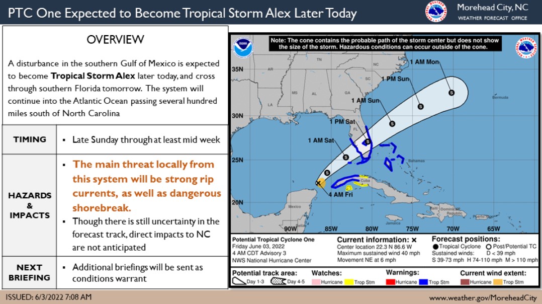
Our office continues to monitor the development and track of a tropical system in the Gulf of Mexico. The current forecast for this storm has it passing several hundred miles off of North Carolina's coast, causing strong rip currents and dangerous shorebreak. No other impacts are expected.
Please see the email below and attached briefing from the National Weather Service for more information.
As always, thank you all for what you do to keep Beaufort County informed, prepared and safe.
Chris Newkirk
Deputy Director
Beaufort County Emergency Services
1420 Highland Dr
Washington, NC 27889
Office: (252)940-6511
Cell: (252) 378-5352
Good Morning,
Advisories have started on PTC One in the southern Gulf of Mexico, which is expected to become Tropical Storm Alex later today. This system is expected to pass through southern Florida and then emerge into the Atlantic and pass several hundred miles south of NC Sunday.
Though direct impacts are not anticipated with this system, strong rip currents are expected as well as dangerous shorebreak. Swell from this system will reach the NC coast sometime Sunday and likely continue through at least mid next week.
As always, if you have any questions please give us a call 252-223-5737 ext. 6
Regards,
NWS Morehead City
NOAA - National Weather Service
Newport/Morehead City, NC Weather Forecast Office
533 Roberts Rd
Newport, NC 28570