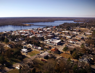
Highway 17 has now completed the southern leg of the proposed bypass, around part of New Bern, which will make travel much faster for those traveling along North Carolina's farthest east, north / south corridor.
Sometime between 8:30 am Friday and 12:20 pm Monday, which is the span of time between my travel along the "seaside highway," is when I ultimately noticed the temporary signage, in the Tuscarora Rhems Road area of U.S. Highway 17 South of New Bern, specifying that the bypass was open for travel. This stretch of the proposed bypass is an estimated 5.2 miles until it empties into U.S. Hwy. 70, which runs basically west to east, just south of New Bern.
 Proceeding up U.S. Hwy. 17 from the South, one is shown the way of the bypass by this magnificent sign: Above. At the end of the bypass one must make a decision as to which direction of U.S. Hwy. 70 to take: Below. photos by Stan Deatherage
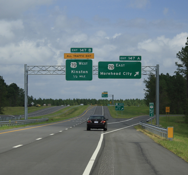
As a well worn traveler of many roads, I truly appreciate the completion of this southern leg of the bypass around New Bern, but be aware that the signage at the north end of the completed bypass directs the traveler to proceed east on U.S. Hwy. 70 to rejoin U.S. Hwy. 17 North. The correct exit for the south to north traveler is exit 411, which is just 8 tenths of a mile further east on Hwy. 70, long before the exit to U.S. Hwy. 17 North at James City.
The reverse route, from north to south on N.C. Hyy. 43, is to go to the end of the four lane of that road, which empties into U.S. Hwy. 70, and head west 8 tenths of a mile on U.S. Hwy. 70 to exit on 410A and head south on the new Hwy. 17 Bypass to rejoin Hwy. 17 South in the Tuscarora Rhems Road area.
All Down-easterners have long used N.C. Hwy 43 as the partial bypass of New Bern. The completed southern leg of the bypass will make the trip around New Bern much faster, and for me a more enjoyable one as well.