Did Beaufort County Dodge the Bullet? Not by a longshot | Eastern NC Now
Earlier I posted the projected path of Hurricane Irene, and openly prayed that the monstrous storm would pass farther east. It did not.
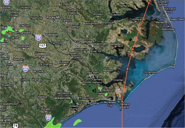
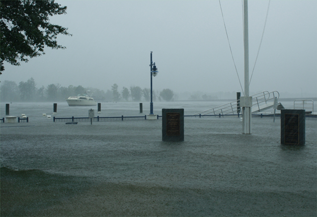
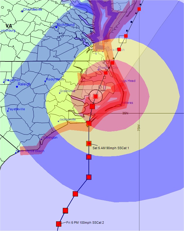 Even in storms as massive as Hurricane Irene the distance of a few miles can make a huge difference. Pitt County just west of Beaufort County sustained hurricane-force winds but in no manner were these winds as long or as strong. Reports from Pitt County shows power coming back on, with everyone back up by tomorrow, August 29th. Initial reports in Beaufort County put the reports of restoring power to all areas at the middle of the next week. We prepare for the worst and hope for the best.


 |
Our office continues to monitor the potential for severe storms and periods of heavy rain between Wednesday and Saturday. Today’s forecast updates shifted some of the early precipitation north and west of our area, which resulted in minor changes to the timing of our expected rainfall
Published: Thursday, July 23rd, 2026 @ 9:40 am
By: ENC NOW
|
 |
Our office is monitoring the potential for severe storms and periods of heavy rain between Wednesday and Saturday. Please see below for Beaufort County's forecast details.
Published: Wednesday, July 22nd, 2026 @ 7:52 pm
By: ENC NOW
|
 |
Memorial Day is a time when we as a nation pause to remember and honor the sacrifice of the men and women who gave their lives in the service of our nation.
Published: Sunday, May 24th, 2026 @ 9:47 am
By: Dave Hudson
|
 |
In 1920, the American Legion adopted the red poppy as the symbol of remembrance of those who gave their lives in war.
Published: Sunday, May 24th, 2026 @ 9:46 am
By: Diane Rufino
|
 |
The great misnomer for non Christians that the day Jesus Christ was executed by occupying Romans, celebrated by Christians as "Good" Friday, must be a paradox of ominous proportions.
Published: Monday, April 6th, 2026 @ 4:22 am
By: Stan Deatherage
|
 |
A North Carolina State Senate race is heading for a recount after the two pro-Trump Republicans come down to a two vote margin.
Published: Sunday, April 5th, 2026 @ 6:43 pm
By: Daily Wire
|
 |
This is simply a failure of will, and we are here to help impose that will today, so that to me is the simple punchline," said State Treasurer Brad Briner. "I appreciate the leaders of Rocky Mount being here, but we need to get to a place where there is the will to fix a very, very serious problem.”
Published: Saturday, April 4th, 2026 @ 8:24 pm
By: Carolina Journal
|
 |
Our office is monitoring the likelihood of severe weather across Eastern NC for tomorrow. Forecast details for Beaufort County include:
Published: Monday, March 16th, 2026 @ 12:20 pm
By: ENC NOW
|
 |
This morning’s update included minor adjustments to snow accumulations, with Beaufort County forecasted to receive between 8 and 12 inches.
Published: Sunday, February 1st, 2026 @ 8:40 pm
By: ENC NOW
|


