

Boldly Committed to Truth Telling in the False Face of Fakery


Across North Carolina: Volume XII


Publisher's note: Please be aware that we have created a new fixture at the foot of this post, describing the location of some of North Carolina's most memorable scenic points of interest, is our interactive map that we developed to do exactly what we want it to do ... for now.
Why am I going back and installing these interactive maps? Simply, folks like to use them because our newer posts are getting more views faster than the older posts did. Providing yet another 'leading edge' product that works is a good enough reason for me.
This is the Twelfth of a new series of images from across North Carolina from my travels, and from the long intervals that I have spent with my camera making a record of where I have been. Upon examination of these random images, I concluded that best format would be the one page arrangement, where I cut the images to 1280 pixels wide, arrayed in a wide viewed 'fancybox' series, where there is a title of explanation, and maybe a bit more, but mainly, the photo should speak rather than my words. In fact, I plan to put my words on hold for a bit here, which will be to the fine relief of a great many.
Each series will be random and varied; however, most will center from here in eastern North Carolina, which is closer to my home in northeastern North Carolina, in the county of Beaufort, and the county seat of Washington, my home. From this perspective, we will reach out beyond the myriad waters: fresh and calm, brackish and moving, salty with powerful waves, and get to see North Carolina, where we may know it a little better, if only through images.
This random display of images of North Carolina, made by the Tar Heel traveler, may have been revealed earlier in BCN, and when I can remember a relative series, I shall link to it; however know that this series of ongoing themes will remain that there is no theme. In this random projection of unrelated images, the series will seek its relevance, its beauty and its strength of purpose.
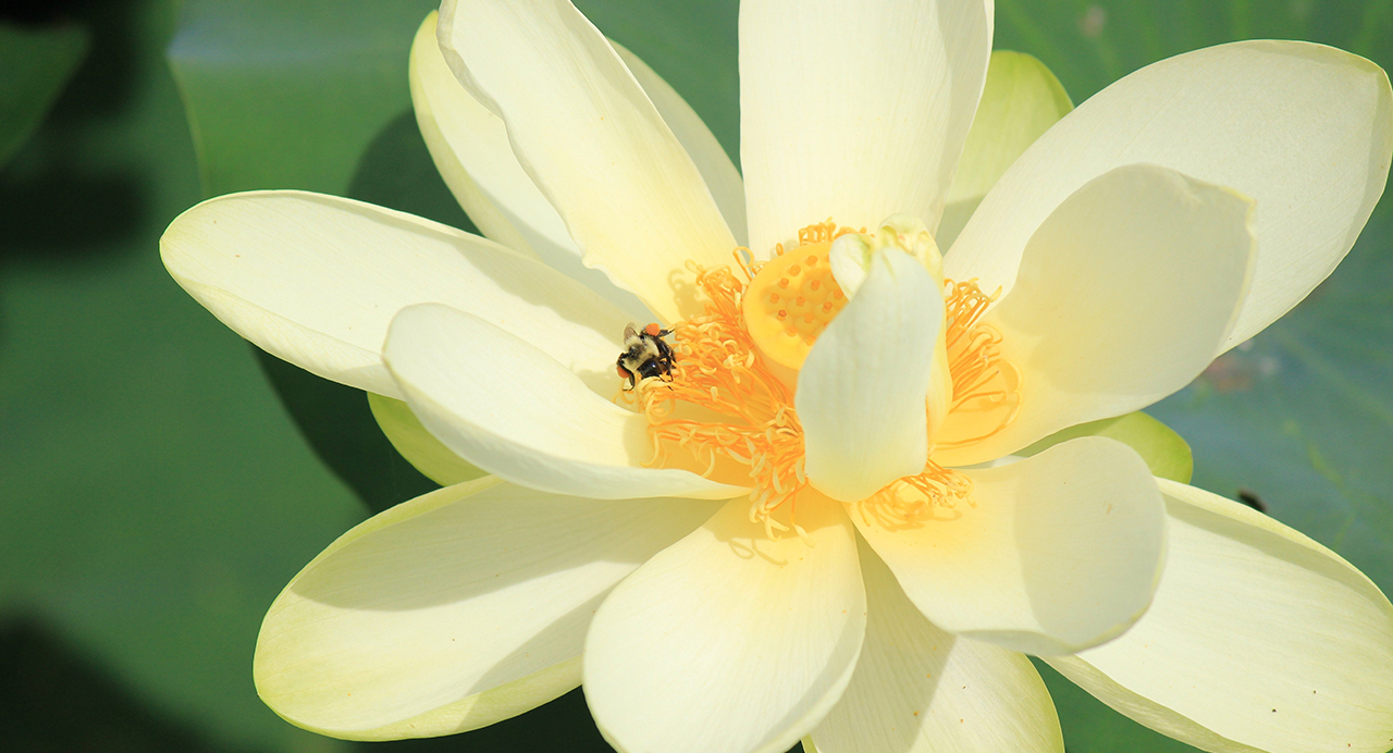
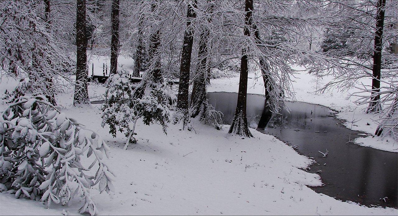
We begin in Beaufort County on a summer's day along Washington's waterfront, where the bee knows best where to gather the nectar: Above. And nature's page is turned to a deep December's snow upon the ground: Below. photos by Stan Deatherage Click images to expand.
We leave Beaufort County, and head north to the heart of rural, sparsely populated northeastern North Carolina - Chowan County, Tyrrell County and Washington County.
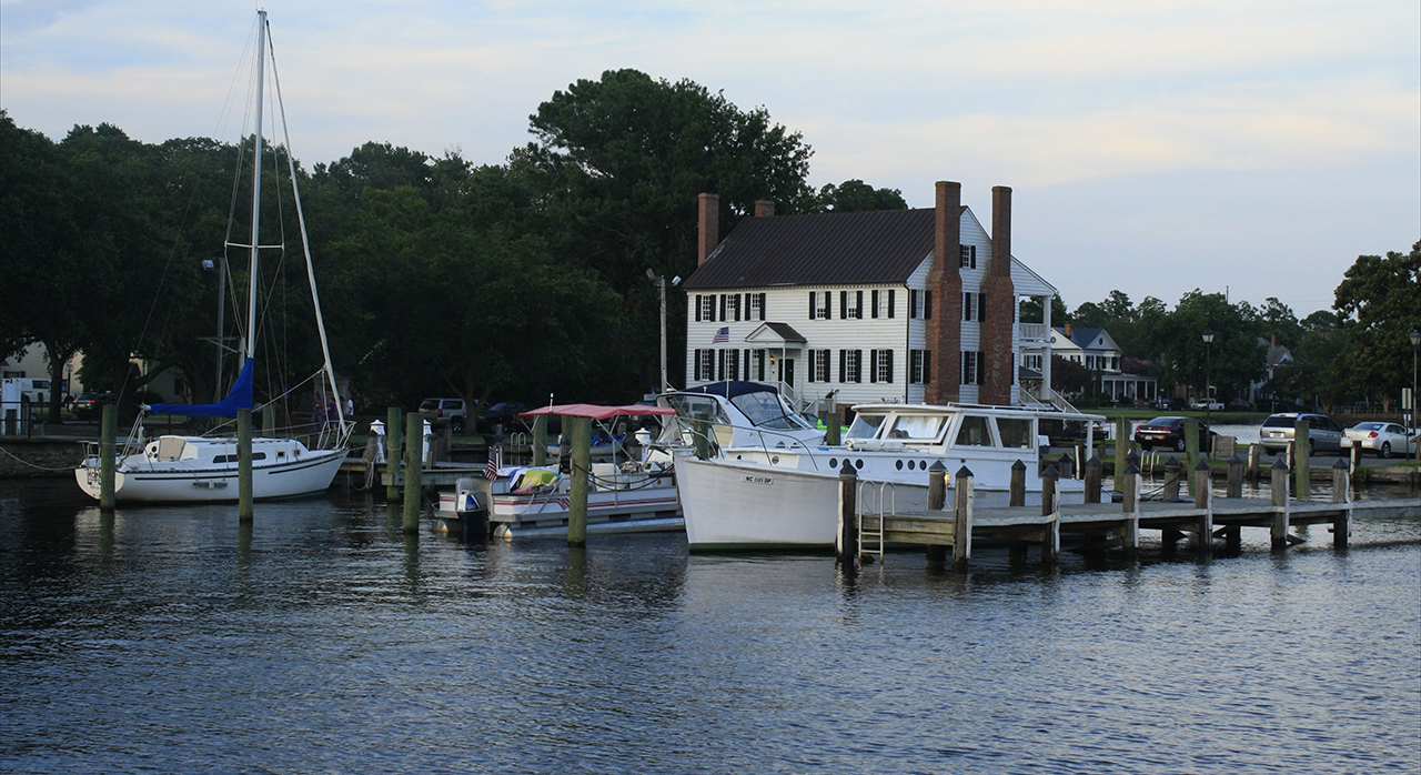
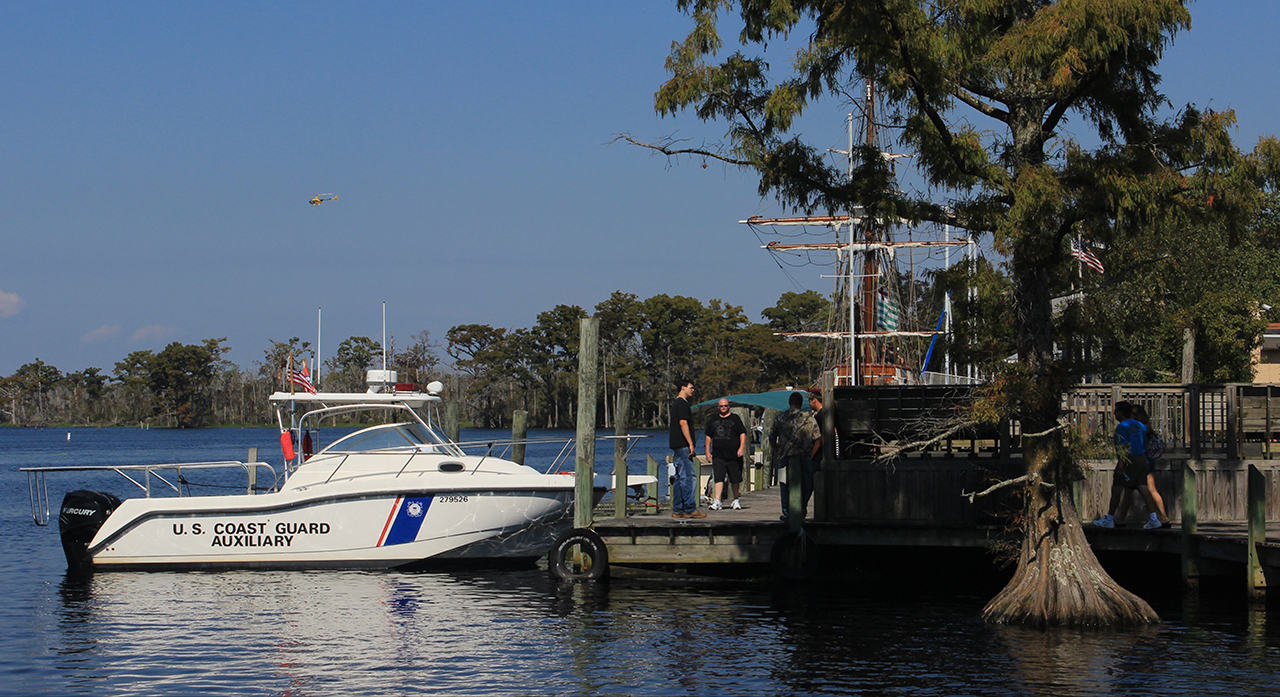
Here along Edenton's waterfront on Edenton Bay that feeds the Chowan River, in Chowan County, we step back in time to visually visit the Barker House: Above. Then we visit Columbia, NC, in Tyrrell County, and its waterfront along the Suppernong River for the annual Scuppernong River Festival: Below. photos by Stan Deatherage Click images to expand.
Northeastern North Carolina, is all about just a few things: farming, hunting, fishing, multiple navigable waterways, and close proximity to the best beaches in the Mid Atlantic region of the United States.
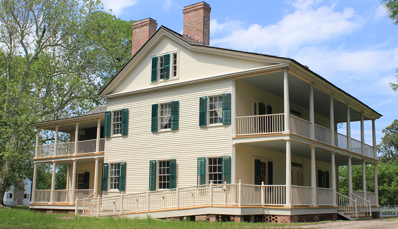
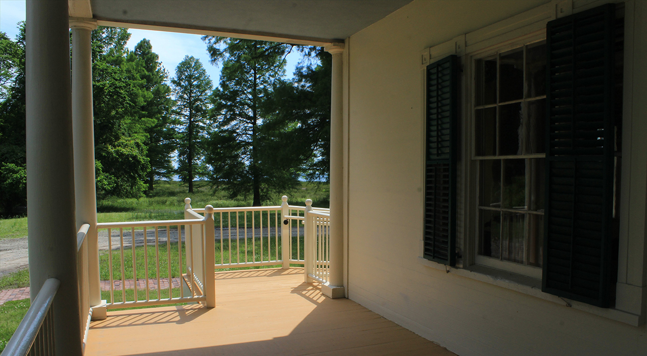
Somerset Plantation in Washington County has been renovated to its former grandeur: Above. From the plantation's front porch, we can see the opening of yet another northeastern North Carolina body of water - Phelps Lake: Below. photos by Stan Deatherage Click images to expand.
But as unique as the watershed for the Pamlico estuary remains, and beautiful it is as a resource, we still find our way to western North Carolina and the Blue Ridge Mountains.
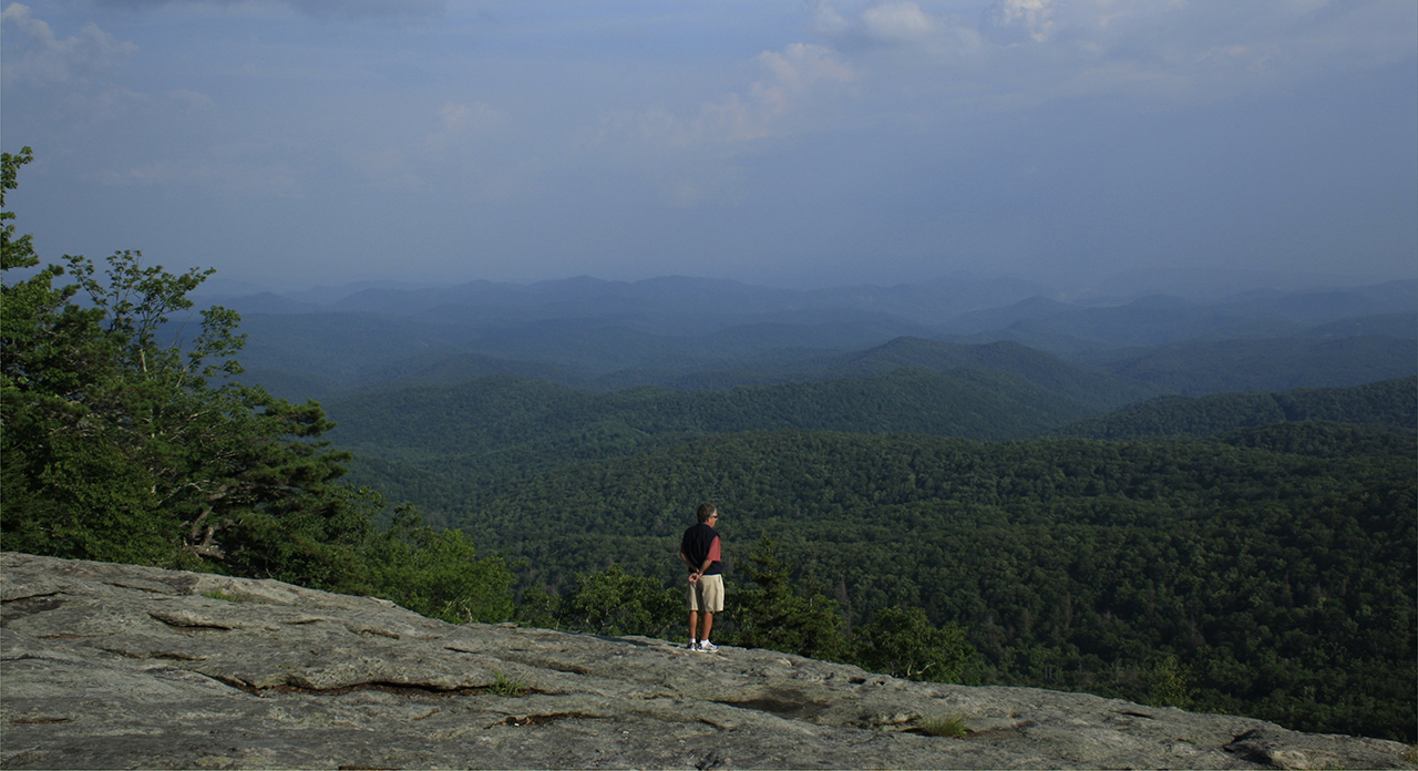
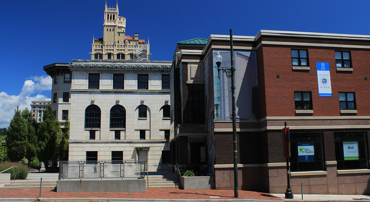
From the weathered rock of the Beacon Heights in Avery County, we see the tall foothills (or rather mountains) of Caldwell County: Above. Just down the highest 'hills' in the eastern United States is Asheville, North Carolina: Below. photos by Stan Deatherage Click images to expand.
Here in Buncombe County, we leave Asheville for its outskirts and the North Carolina Botanical Gardens west of the city.
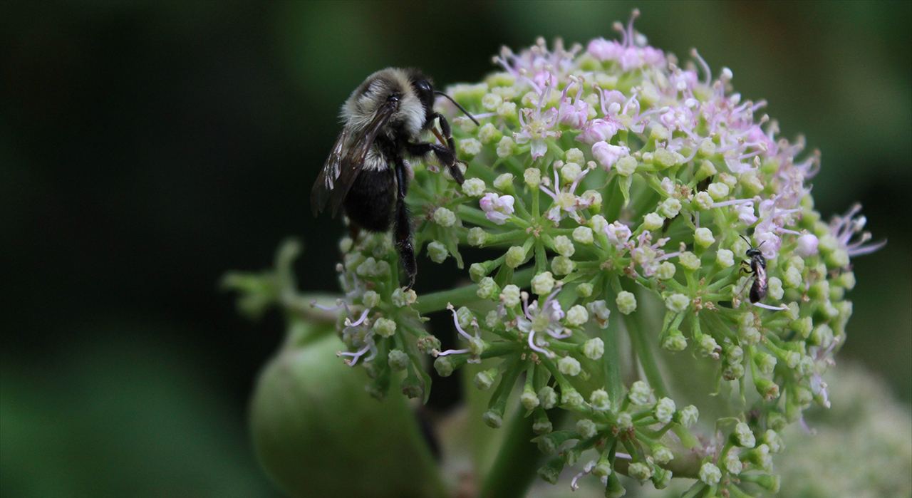
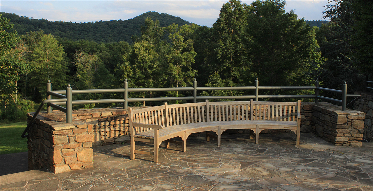
Here in the Botanical Gardens, we see pollination up close: Above. And here we find a bench to take a load off to observe the natural beauty of this fine reserve still in Asheville's Swannanoa valley: Below. photos by Stan Deatherage Click images to expand.
From these serene surroundings, we bound back to North Carolina's northeast, all the way back to the northern Outer Banks to Corolla and Duck.
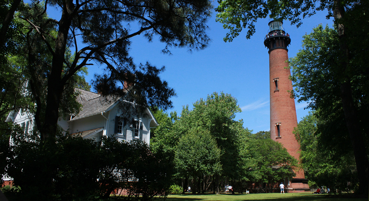
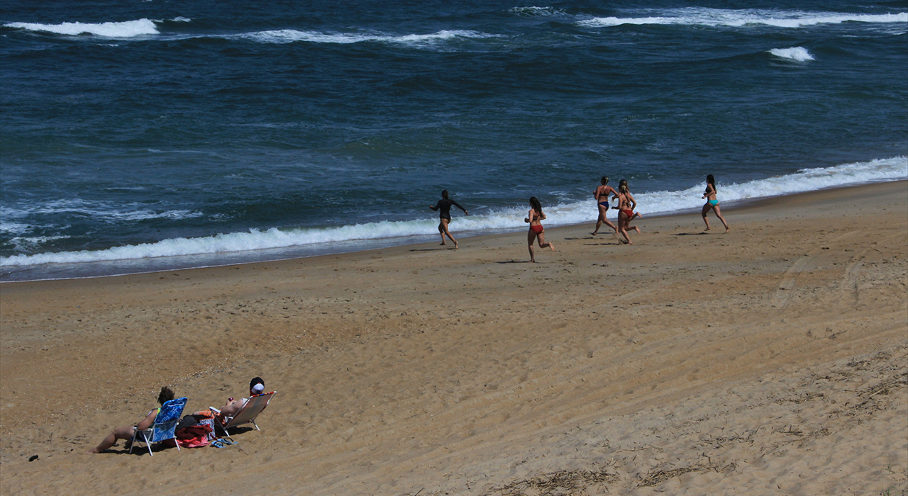
Here adjacent to the Whalehead Club in Corolla, in Currituck County, we pay a visit to the Currituck Light Station: Above. In the seaside and soundside community of Duck, there are those that relax in the warm rays of a late spring afternoon, while the running young women hit the chilled waters of the Atlantic as they train to know the life saving business that will be theirs this coming summer: Below. photos by Stan Deatherage Click images to expand.
And then back home ...
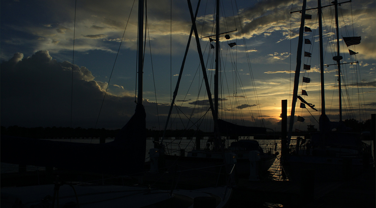
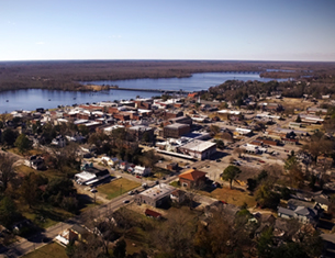
I always finish, where we began, with a sunset image over the Pamlico River, here in Washington, NC: Above. photo by Stan Deatherage Click image to expand.
We'll do another one of these as the time becomes ready and appropriate. At your leisure, please follow this link to the growing list of this pictorial series - "Across North Carolina".
Below is our new interactive map that will show where all the pictures were made, and if you wish, you can get the distances and directions to these vistas. Also, you can interact with the map by placing your address in the "Enter an Address or Place & Click Find" field, and then click find to get best directions and mileage between your address and the chosen subject site. More features to follow.
Go Back
Why am I going back and installing these interactive maps? Simply, folks like to use them because our newer posts are getting more views faster than the older posts did. Providing yet another 'leading edge' product that works is a good enough reason for me.
This is the Twelfth of a new series of images from across North Carolina from my travels, and from the long intervals that I have spent with my camera making a record of where I have been. Upon examination of these random images, I concluded that best format would be the one page arrangement, where I cut the images to 1280 pixels wide, arrayed in a wide viewed 'fancybox' series, where there is a title of explanation, and maybe a bit more, but mainly, the photo should speak rather than my words. In fact, I plan to put my words on hold for a bit here, which will be to the fine relief of a great many.
Each series will be random and varied; however, most will center from here in eastern North Carolina, which is closer to my home in northeastern North Carolina, in the county of Beaufort, and the county seat of Washington, my home. From this perspective, we will reach out beyond the myriad waters: fresh and calm, brackish and moving, salty with powerful waves, and get to see North Carolina, where we may know it a little better, if only through images.
This random display of images of North Carolina, made by the Tar Heel traveler, may have been revealed earlier in BCN, and when I can remember a relative series, I shall link to it; however know that this series of ongoing themes will remain that there is no theme. In this random projection of unrelated images, the series will seek its relevance, its beauty and its strength of purpose.
The Twelfth Pictorial Trek from Here to There and Back Again
We leave Beaufort County, and head north to the heart of rural, sparsely populated northeastern North Carolina - Chowan County, Tyrrell County and Washington County.
Northeastern North Carolina, is all about just a few things: farming, hunting, fishing, multiple navigable waterways, and close proximity to the best beaches in the Mid Atlantic region of the United States.
But as unique as the watershed for the Pamlico estuary remains, and beautiful it is as a resource, we still find our way to western North Carolina and the Blue Ridge Mountains.
Here in Buncombe County, we leave Asheville for its outskirts and the North Carolina Botanical Gardens west of the city.
From these serene surroundings, we bound back to North Carolina's northeast, all the way back to the northern Outer Banks to Corolla and Duck.
And then back home ...
We'll do another one of these as the time becomes ready and appropriate. At your leisure, please follow this link to the growing list of this pictorial series - "Across North Carolina".
Loading Google Map...Please Wait...
| Enter an Address or Place & Click Find | ||
Locations; Click to View

| Vietnam War: USS Enterprise Fire ‘69 | Across North Carolina, Body & Soul, Travel | The Politician and Whiskey Story |


Home
Contact
About
Service Rates
Privacy Policy
Follow on Facebook
Subscribe to Newsletters
Rss Feed
Keywords
Eastern NC Now & ENC NOW © Copyright 1998-2024 All Rights Reserved.
