Across North Carolina: Volume IX | Eastern North Carolina Now
This is the ninth of a new series of images from across North Carolina from my travels, and from the long intervals that I have spent with my camera making a record of where I have been.
Under the cover of Covid, and now in the shadow of the infamous Election Irregularities of that fated 2020 presidential election, with current emerging alleged election fraud in Nevada and Pennsylvania inconveniently slipping into the public discourse, there is proved a colluded ongoing Election Interference in the nomination of the Republican candidate, the likes of which has never occurred in our Constitutional Republic's history, albeit, the question remains: Do you support the plain-sight Election Interference of the Democratic Socialist party, employing its minions in their Propagandistic Media, and their Two Tiered Justice System?
98.13% No, I do not support Election Interference; I am a patriot unto our Constitution.
0.93% Yes, I do support Election Interference; the alternative, Donald Trump, to this mentally diminished president is far worse.
Publisher's note: Please be aware that we have created a new fixture at the foot of this post, describing the location of some of North Carolina's most memorable scenic points of interest, is our interactive map that we developed to do exactly what we want it to do ... for now.
Why am I going back and installing these interactive maps? Simply, folks like to use them because our newer posts are getting more views faster than the older posts did. Providing yet another 'leading edge' product that works is a good enough reason for me.
This is the ninth of a new series of images from across North Carolina from my travels, and from the long intervals that I have spent with my camera making a record of where I have been. Upon examination of these random images, I concluded that best format would be the one page arrangement, where I cut the images to 1280 pixels wide, arrayed in a wide viewed 'fancybox' series, where there is a title of explanation, and maybe a bit more, but mainly, the photo should speak rather than my words. In fact, I plan to put my words on hold for a bit here, which will be to the fine relief of a great many.
Each series will be random and varied; however, most will center from here in eastern North Carolina, which is closer to my home in northeastern North Carolina, in the county of Beaufort, and the county seat of Washington, my home. From this perspective, we will reach out beyond the myriad waters: fresh and calm, brackish and moving, salty with powerful waves, and get to see North Carolina, where we may know it a little better, if only through images.
This random display of images of North Carolina, made by the Tar Heel traveler, may have been revealed earlier in BCN, and when I can remember a relative series, I shall link to it; however know that this series of ongoing themes will remain that there is no theme. In this random projection of unrelated images, the series will seek its relevance, its beauty and its strength of purpose.
The Ninth Pictorial Trek from Here to There and Back Again
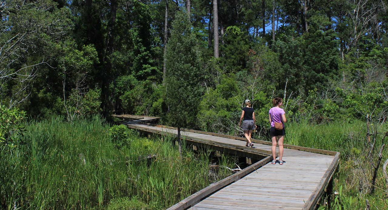
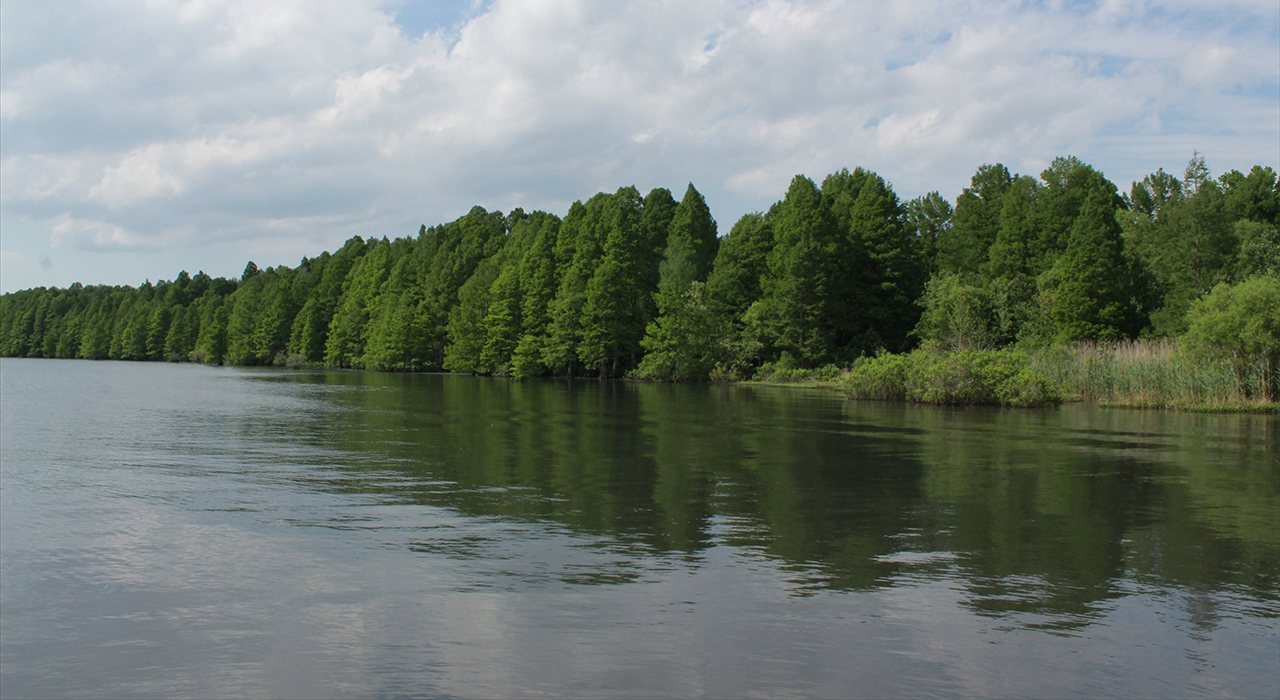
We begin in Goose Creek State Park along the walkway that takes one to where the mouth of Goose Creek meets the Pamlico River: Above. Another pastoral setting is always the shoreline of Lake Phelps in Washington County at Pettigrew State Park: Below.photos by Stan DeatherageClick images to expand.
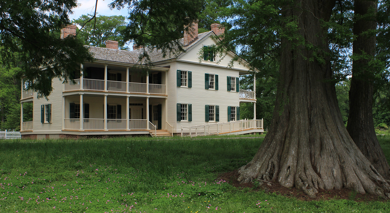
While remaining in Washington County, we pay a visit to one of North Carolina's few remaining plantations from colonial days - Somerset Plantation - along the shores of Lake Phelps.
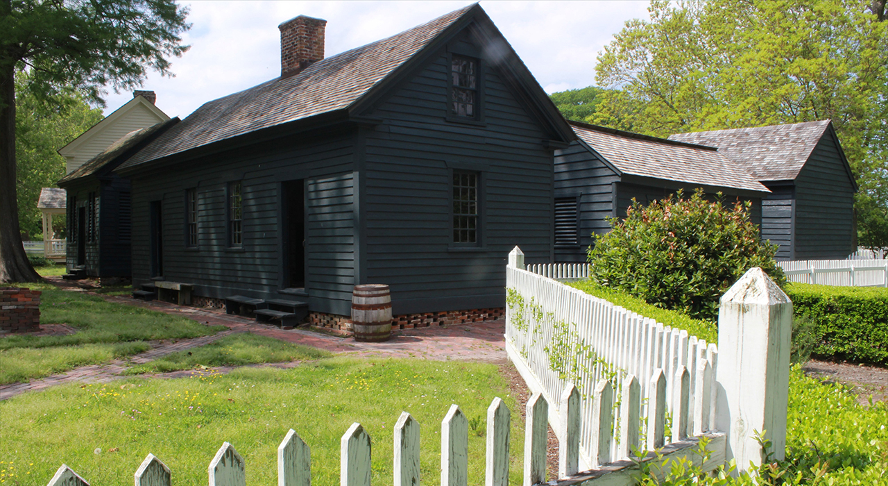
The view of Somerset from lake Phelps, and what a magnificent Cypress in the foreground: Above. To the rear of Somerset, there are working outhouses, the closest to the plantation's kitchen. Was my camera showing smudges in this picture, and the other 6 images that I took of this scene from different angles (did not show up in any other images from that day), or are these the infamous orbs floating in a much storied location(?): Below.photos by Stan DeatherageClick images to expand.
Eastern North Carolina, from north to south, here Downeast, is a most unique stretch of ground where real people live, and have lived.
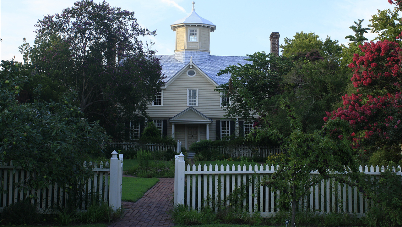
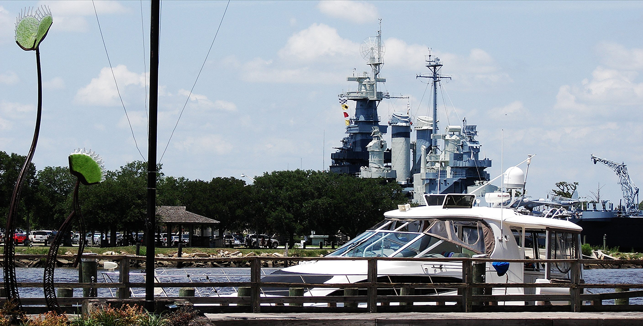
Remaining in eastern North Carolina, here in Edenton's Historic District, we are acquainted with the front view of the Cupola House: Above. Then south and west along the southeastern coast of the Old North State we exhibit the 'Showboat', the USS North Carolina moored across the Cape Fear River from Wilmington: Below. photos by Stan DeatherageClick images to expand.
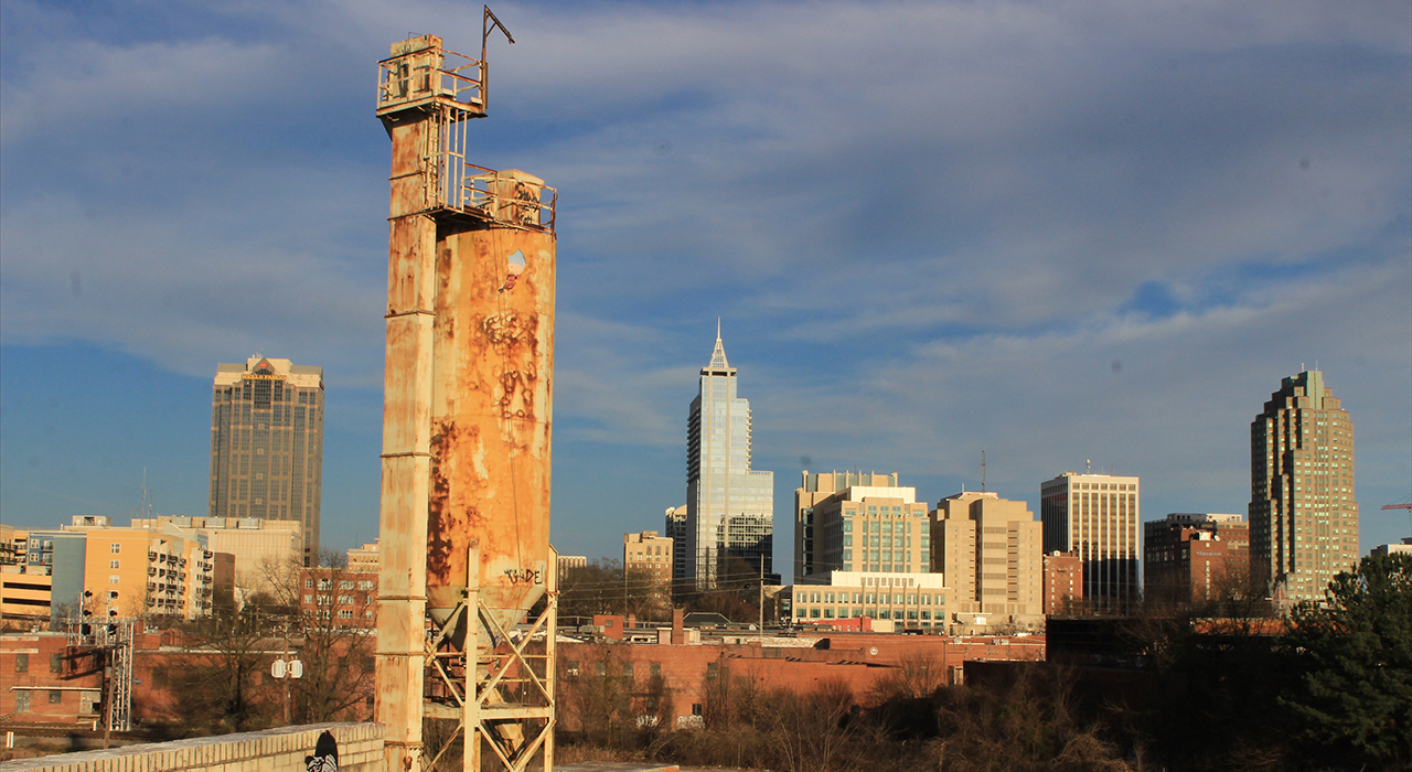
It is difficult to get anywhere in North Carolina, from east to west without going through Raleigh, or at least being close to it.
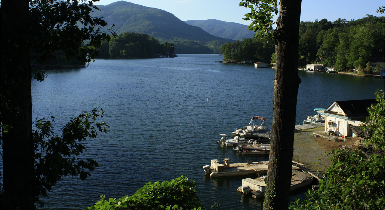
So, we make an image of the western view of the downtown skyline from Boylan Ave.: Above. Then there is Lake Lure where the foothills become mountains, a must experience if one can tear themselves away from North Carolina's storied coast: Below.photos by Stan DeatherageClick images to expand.
The zig zag from west to east is the way of it as we return to North Carolina's coast.
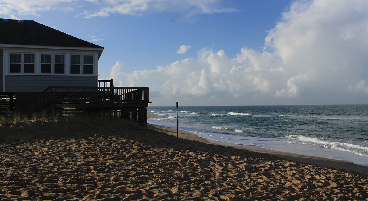
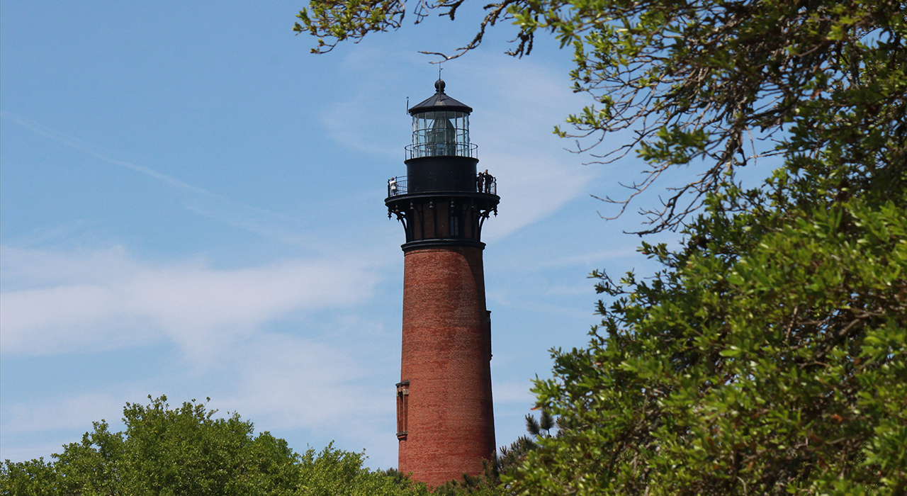
We return to the Outer Banks, this time at Kitty Hawk, with the outer bands of Tropical Storm Ana swirling from horizon to horizon. This is low tide at the beach, where many houses are in danger of slipping away: Above. But not here in Corolla, where the Currituck Light Station sits high upon the inner island sands in the northern North Carolina Outer Banks: Below. photos by Stan DeatherageClick images to expand.
Once one is situated in the northern Outer Banks, you can not exclude Duck, NC from your itinerary, from a geographical necessity or a cultural perspective.
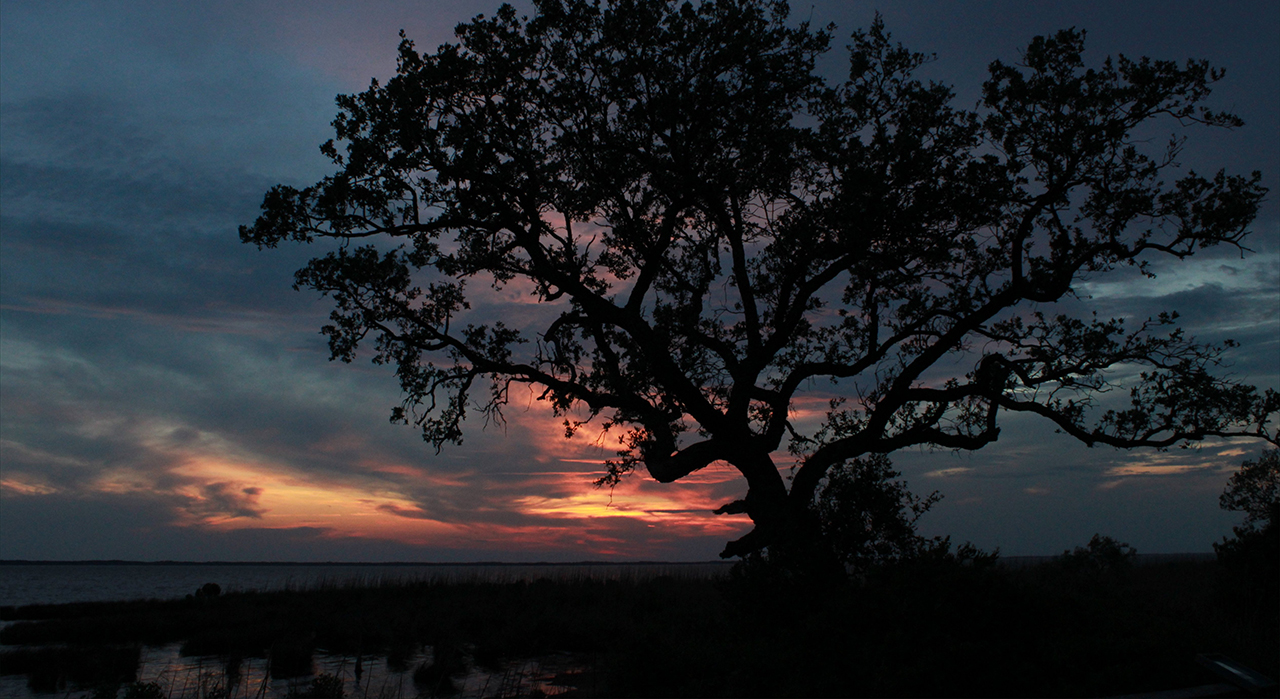
Here, we spy on a fat Nutria in the shallows of the Currituck Sound: Above. Then, we bid goodbye to the last of the day near those same shallows where the nutria are so abundant: Below.photos by Stan DeatherageClick images to expand.
And then back home ...
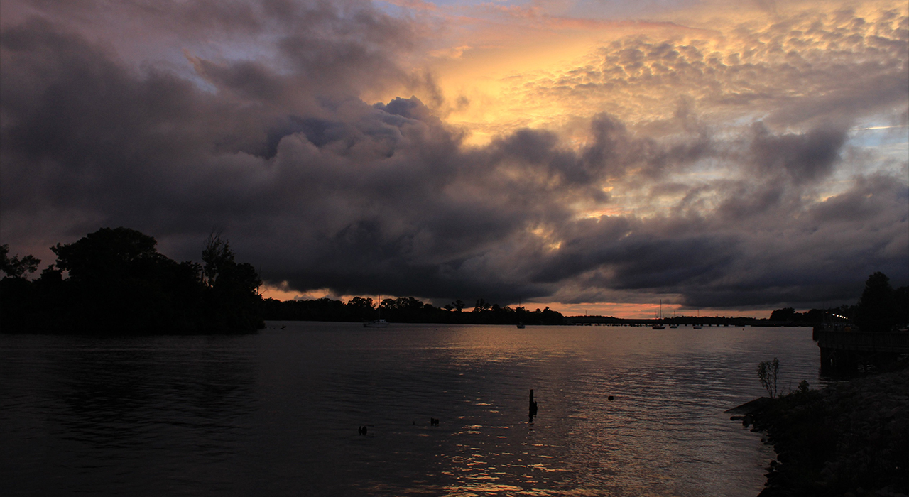
Where I always finish with a sunset image over the Pamlico River in Washington, NC: Above. photo by Stan DeatherageClick image to expand.
We'll do another one of these as the time becomes ready and appropriate. At your leisure, please follow this link to the growing list of this pictorial series - "Across North Carolina".
Below is our new interactive map that will show where all the pictures were made, and if you wish, you can get the distances and directions to these vistas. Also, you can interact with the map by placing your address in the "Enter an Address or Place & Click Find" field, and then click find to get best directions and mileage between your address and the chosen subject site. More features to follow.
You will always be able to shine a light through a negative and produce a photo.
It will be impossible to see our digital photos in 10 years unless you save the hardware and software for viewing. That is from a Netflix show archiving movies.
A liberal photographer is one who tries new equipment and techniques regardless of costs or results. A conservative photographer still uses a 1920 box camera.
A moderate like myself lives like an amphibian in both worlds. That came to me after a coffee overdose. Great photos.
I believe in free markets for free men, and I despise the tyranny of the EPA, and am hopeful that soon congress will reign in their unprincipled, unconstitutional behavior.
Do you think we are wise to Frack inland and drill Offshore between the Outer Banks and Gulf Stream in the Graveyard of the Atlantic. I would so hate to see the little animal covered in goo from a blow out . . .


A. I back everything up in many places, and I pray that all of my storage points are pristine: and more importantly ...
B. We will always keep our servers, and I will never let any posts die, and certainly no images. We get too much traffic to ever consider such.