Deadly storm system makes its way to Beaufort County | Eastern North Carolina Now
The storm system responsible for causing more than 150 reported tornadoes and at least 280 deaths across Mississippi, Tennessee, Alabama and Georgia will pass through Beaufort County this afternoon.
Now that Kamala Harris has been coronated the Democratic Socialist designee for nomination as their candidate for President of these United States, after that political party's contrived primary process "democratically" elected Joseph R. Biden: What are your feelings about this party's progressive posture within their self-styled exercise of "Saving Democracy for America," and how truly critical the outcome of this presidential election will be?
0% I am ecstatic that this "Democracy's" First partially Black, First partially Indian, First female Co-Parent, and that this nation's primary necessity is to elect our First woman president.
14.29% I really do not care about all these "Firsts." I will continue to pray, and work for this Representative Republic to elect someone competent, and brilliantly patriotic to be our next president.
85.71% I will never vote for any politician that "first" does not have the core values to understand how dire this Constitutional Republic's situation has become.
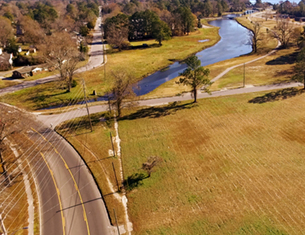
The same storm system responsible for causing more than 150 reported tornadoes and at least 280 deaths across Mississippi, Tennessee, Alabama and Georgia will pass through Beaufort County before it pushes off the East Coast and into the Atlantic later this evening.
Beaufort County residents should be prepared for possible damaging winds, large hail and isolated tornadoes, which could last from around noon today until about 9 p.m. The storms will likely become more severe as the afternoon progresses, peaking around 4:30 p.m.
The Weather Channel's severe-weather expert Greg Forbes estimates the likelihood of tornadic activity today in eastern North Carolina, on a scale from 0 (no probability) to 8 (high probability), to be around a 4 (low chance of a tornado).
This estimate may promote overly optimistic thinking; but it shouldn't, however, as the level of 4 is the highest level Forbes attributed to any location in the path of the storm system. Other areas, such as New York, only received a rating of 2 to 3 (very low chance of a tornado), and, currently, New York is under a Tornado Warning, which means there has already been at least one tornado spotted there.
As of noon today, the National Weather Service has issued a Tornado Watch until 4 p.m today, and a wind advisory until midnight tonight.
Beaufort County residents should prepare for the worst and hope for the best. To prepare for a possible tornado, pick the lowest place in your house to take cover, preferably a basement. If you don't have a basement, find an interior hall or closet that is away from any glass. Have a mattress available to cover yourself to protect against flying debris. Turn off your gas meter with a wrench, kept nearby, in the case of a tornado. If you live in a mobile home, try to find another place to wait out the storm when there is a tornado watch. and run tornado drills before severe weather. This will lessen the chance of confusion if a tornado hits. If you are in a car, pull to the side of the road and get out of the car (get in a ditch if possible). You cannot outrun a tornado.
A result of a cold front and strong low-level jet stream, the storm system that has ravaged the South over the past three days is the worst to hit the area since 1974, when 315 were killed. The death toll is expected to rise and could, at some point, supersede the 1974 storms in the level of total destruction.
To see a radar map of the storm, click here, and then click "Enlarge" at the top of the satellite image.
To see what a close encounter with an EF4 tornado might look like, view the below video footage that was taken by a resident of Tuscaloosa, Ala, as the storm passed through, yesterday.
For a shocking video of the 1.5-mile wide tornado that swept across Birmingham, Ala., yesterday, view the video below. Because the funnel was so large, the videographers didn't even realize that they were capturing an actual tornado.
This morning’s update included both good and bad changes for our area, with another reduction in the total rainfall but an increased threat of tornados.
This afternoon’s update included a reduced threat of storm surge for our area, and an increased concern for downriver flooding for areas along the lower Tar River early next week as a result of inland rainfall.
Debby continues to live up to its reputation of being a difficult storm to forecast, and we appreciate everyone’s patience as we navigate these changes in real time.
The afternoon updates have included another increase in expected rainfall amounts, and provided us with additional details related to the timing of our forecasted impacts.
Recent weather updates continue to include minor track and timeline adjustments to Debby’s path along the eastern US, as well as an increase in forecasted rain fall and expected winds for our area.
Recent weather updates continue to include minor track and timeline changes to Debby’s path along the eastern US. Forecast models continue to vary on the where Debby will stall, and the track it will take afterwards.
Recent weather updates included minor timeline changes to Debbie’s track along the eastern US. While forecast models continue to become more aligned, there are still unknown variables that could determine the expected impacts for Beaufort County.
We would like to have quick briefing with our county’s municipal leaders and public safety partners to discuss our response to the potential impacts of Tropical Storm Debby tomorrow, Tuesday 8/6 at 7pm.
Our office is monitoring the forecast of an approaching front moving through this afternoon that could produce heavy rainfall, isolated strong to severe thunderstorms, strong winds, coastal flooding, and dangerous marine conditions.
Our office is currently monitoring an approaching weather system that will bring windy conditions, rain, and the potential for strong storms to our area tomorrow.
The great misnomer for non Christians that the day Jesus Christ was executed by occupying Romans, celebrated by Christians as "Good" Friday, must be a paradox of ominous proportions.


 The same storm system responsible for causing more than 150 reported tornadoes and at least 280 deaths across Mississippi, Tennessee, Alabama and Georgia will pass through Beaufort County before it pushes off the East Coast and into the Atlantic later this evening.


