Calf Creek Preserve Exposition: July, 2024 Edition, Volume Two - Tracts A, B, C, G | Eastern North Carolina Now
This effort in exposition begins the noble experiment of many years of planning this land, deep within the Chocowinity Bay /Pamlico River watershed, and how capture its essence, and its true value as an eclectic mixed use community.
Since the Democratic Socialist campaign message has been that the Republican nominee, "Donald Trump is a threat to Democracy," is it not exceedingly ironic that the leadership of the Democratic Socialist party is endeavoring to remove their presumptive nominee - Joseph R. Biden, though elected - as their candidate for the presidency of the United States?
5.88% The Democratic Socialists reserve the right to always be incredibly flexible in all matters pertaining to communicated core ideals.
94.12% The Democratic Socialists are long on hyperbolic promise, but way short on purposeful performance, ergo, they are grand hypocrites of the first order.
Wooded and natural, trees, mostly dry-natured hardwoods abound, where wildlife and seclusion make for a natural mix of perfection for the humankind that crave peace and solitude. In this understanding of of the complexities of blending the natural environment of wilder life with we, humankind, Tracts A, B and C will serve different purposes in this mixed-use approach to reimagining that total existence of living things.
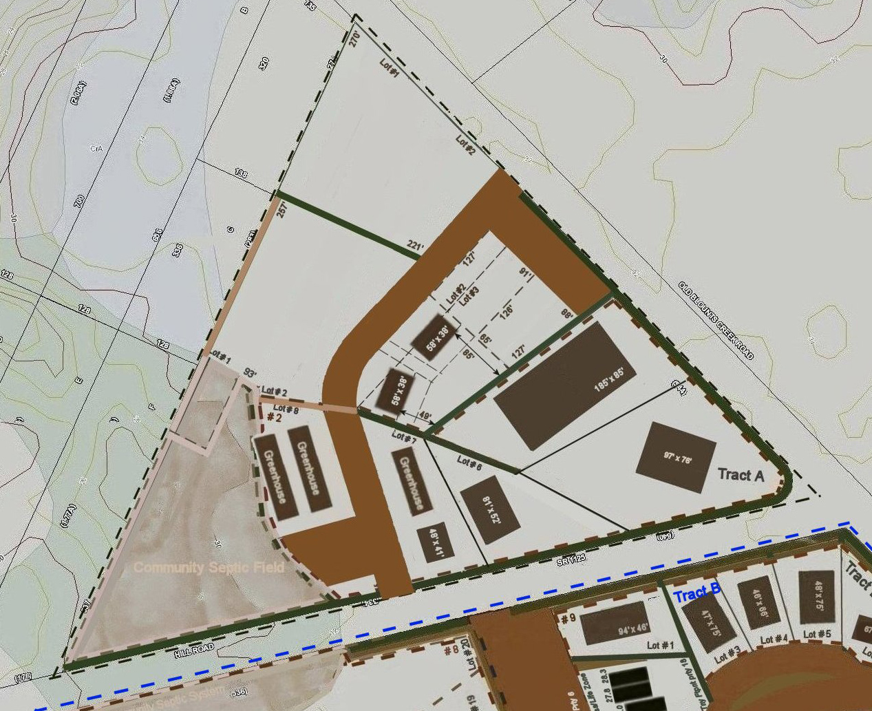
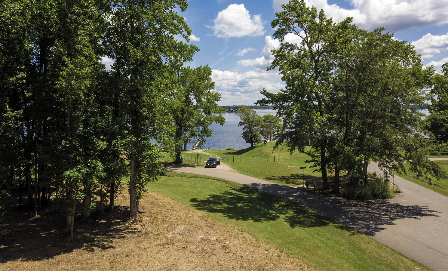
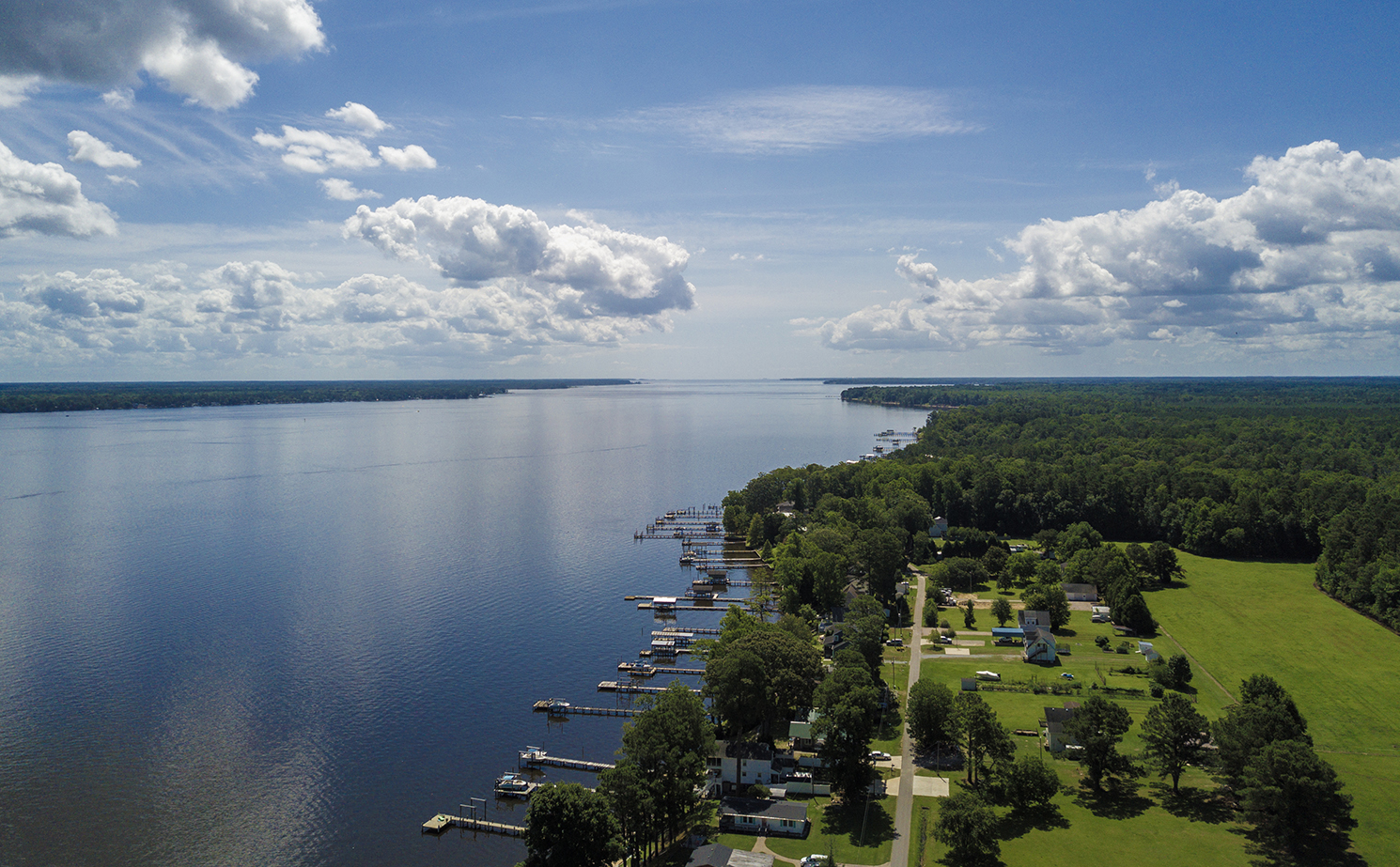
Map of Plans of Tracts A, B, C, D, G: Above. Looking west toward Tract B and Tract A, in Summer of 2024; Tract A further west: Below.Map and drone images created by SNI Productions. Click map and image to expand.
Tract A
A triangular space of ground with outstanding access by frontage on two hard surfaced state roads.
Tract A, the commercial corner, with an estimated 976 feet of state road frontage on Old Blounts Creek Road and an estimated 1,138 feet of frontage on Hill Road; an estimated 11.621 acres comprising Tract A, will be a commercially inspired public space with no need of the waterfront access located at the end of Moores Beach Road, deeded access which is offered to most of the Tract B owners, and all of the owners of Tract C property.
Sewer, supplied by the Town of Chocowinity, is only a scant few thousand feet west on Old Blounts Creek Road, and could possibly be negotiated if needed. Otherwise, there are soils for some variation of a functional septic system on Tract A, along with the many commercial possibilites, including storage and public access to "crafting shops" considering the property's close proximity to Cypress Landing.
:Tract A, within the spectrum of our Map of Plans, shows a picture of many possibilities due to its ample road frontage, and corner location - the first full corner on the river road on the south side of the Pamlico River: Above.Map created by SNI ProductionsClick image to expand.
Looking north across Lot #4, Tract S toward the waterfront access lot for Calf Creek Preserve; the building site for this relatively large homesite with many magnificent views is about 30 feet above sea level: Below. Drone images by SNI ProductionsClick image to expand.
Calf Creek waterfront, waterview in the guise of Tract S, with the Community's Waterfront access lot for the entire community: Below.Created by SNI ProductionsClick image to expand.
Looking down the Pamlico River over the easterly development of Ridgecrest, past Blounts Bay, and further southeast to the mouth of the Pamlico River: Above.Drone images by SNI ProductionsClick image to expand.
Deatherage & Associates, Broker #82765 - Stan Deatherage, GRI - 252.946.2361 | stan@beaufortcountynow.com, will be handling the sales of all lots; The Chocowinity Bay Company is acting as developer /planner, with the property being sold in individual lots, and larger chunks to qualified buyers.
Owner financing possible for qualified purchasers.