

Your Public Square Disclosing what is True, what is Real


Dare County (1870)


Publisher's note: We believe the subject of history makes people (i.e., American people) smarter, so in our quest to educate others, we will provide excerpts from the North Carolina History Project, an online publication of the John Locke Foundation. This eighth installment, by Jonathan Martin, is provided courtesy of the North Carolina History Project, and re-posted here with permission from NC Historic Sites.
Dare County, one of North Carolina's coastal counties, has a rich history with national significance. Named for America's first English child, Virginia Dare, this northeastern county was originally part of the Tyrrell, Hyde, and Currituck Counties. In 1870, the North Carolina Legislature passed an act that separated Dare County to make transportation improvements as well as an increase in taxing procedures.
Manteo, the county seat, is named in honor of the Croatoan who helped the English establish the Roanoke Island Colony. Other communities within the county include Kitty Hawk, Nags Head, Wanchese, Kill Devil Hills, and Southern Shores. Also, Dare County has nearly 85 miles of uninterrupted coastline, and includes the famed Roanoke Island.
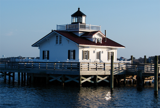
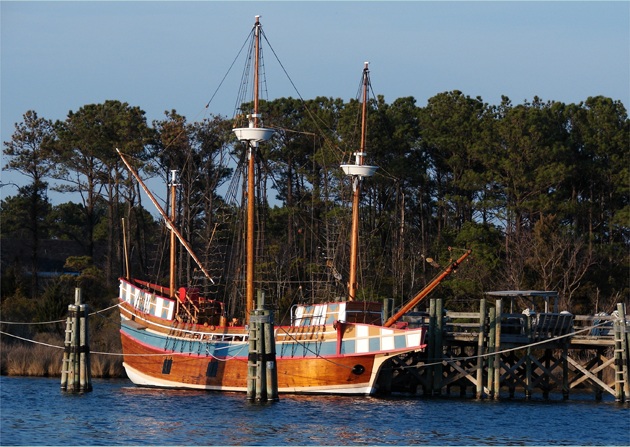
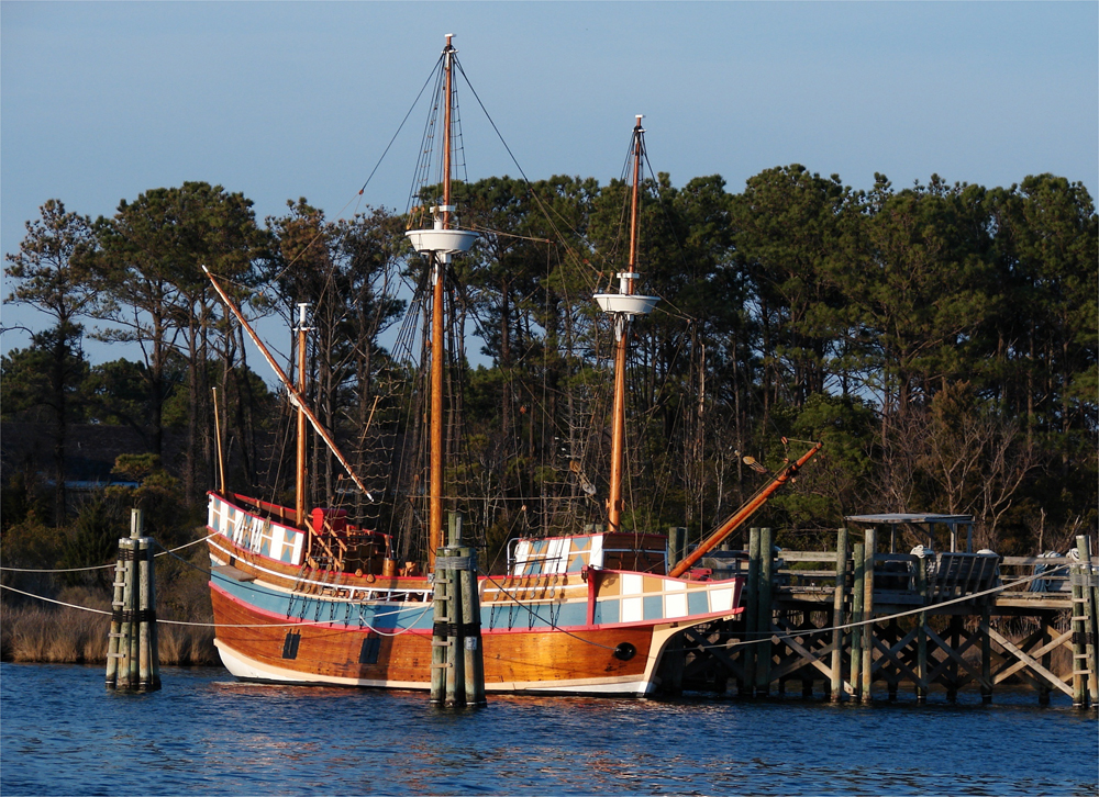
The waterfront village of Manteo, located snugly on Roanoke Island, is the county seat of Dare. This screwpile lighthouse, in Shallowbag Bay, which spills into the Roanoke Sound, is located on the waterfront of Manteo: Above. The Queen Elizabeth replica has a permanent mooring across from the Lighthouse and the village of Manteo: Below. photos by Stan Deatherage Click the picture to expand to as much as 1000 pixels wide within most expanded images, and then push the arrows embedded in the center edge of the play-box to access the gallery, and slide new images into viewing within the center of the screen.
Formerly occupied by the Croatoan before English settlement, Dare County was the site of many colonization attempts. In the 1580s, Sir Walter Raleigh, the famous British adventurer and soldier, tried to establish a colony, in what he considered a New World, on Roanoke Island, but a lack of supplies doomed his efforts. After several years of isolation from the Old World, rescuers were unable to locate any colonists--of whom the whereabouts and fate are still an unsolved mystery.
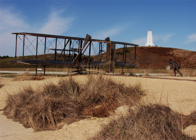
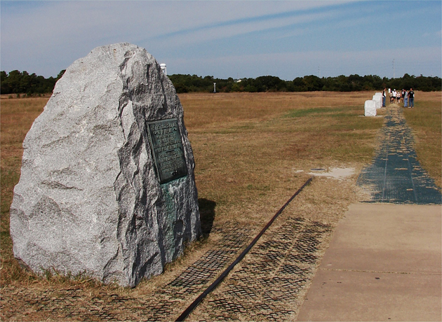
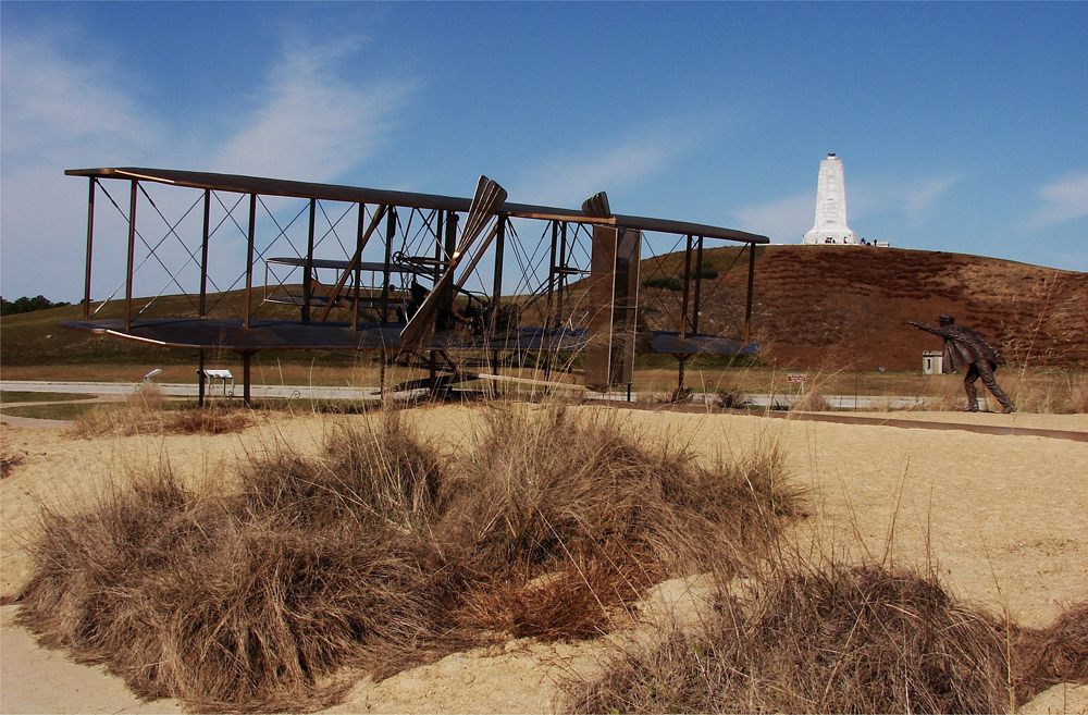
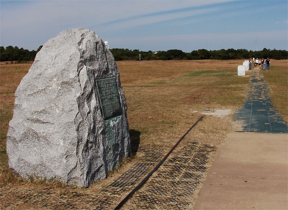
Here we see the bronze statue of Wilber Wright, in this action based bronze sculpture, with the Wright Brothers Memorial on the last remaining large, high dune, urging his brother, Orville, in the first flight of a fixed wing aircraft: Above. The high dunes where the first flight occurred have are shifted by the varying winds, and gone, but here remains these stones in a linear line denoting the location and the duration of that first flight: Below. photos by Stan Deatherage Click the picture to expand to as much as 1000 pixels wide within most expanded images, and then push the arrows embedded in the center edge of the play-box to access the gallery, and slide new images into viewing within the center of the screen.
The success of Wilbur and Orville Wright's first flight occurred in Dare County. Performing one of the most important events of the twentieth century, Orville Wright flew "The Flyer" 120 feet in 12 seconds on December 17, 1903, in Kill Devil Hills. Although several witnesses remarked at how anti-climatic the event was, the brothers attempted several more flights with the longest lasting nearly one minute and reaching a distance of 852 feet. The Wright Brothers National Memorial commemorates this accomplishment.
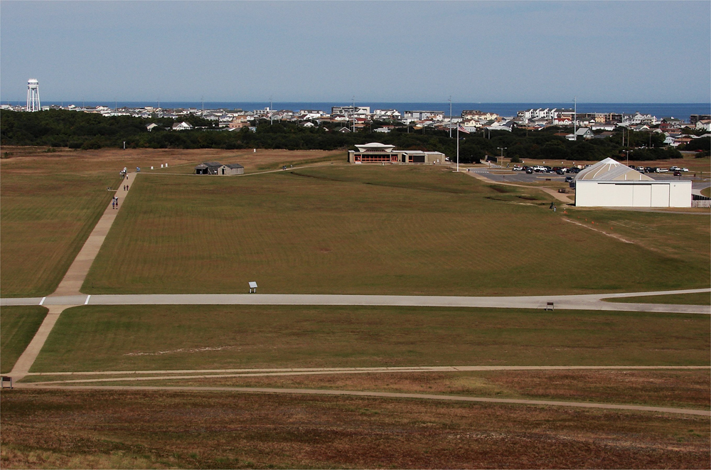
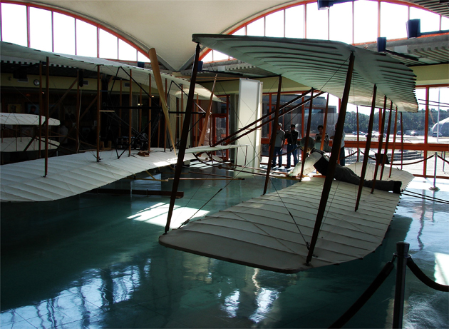
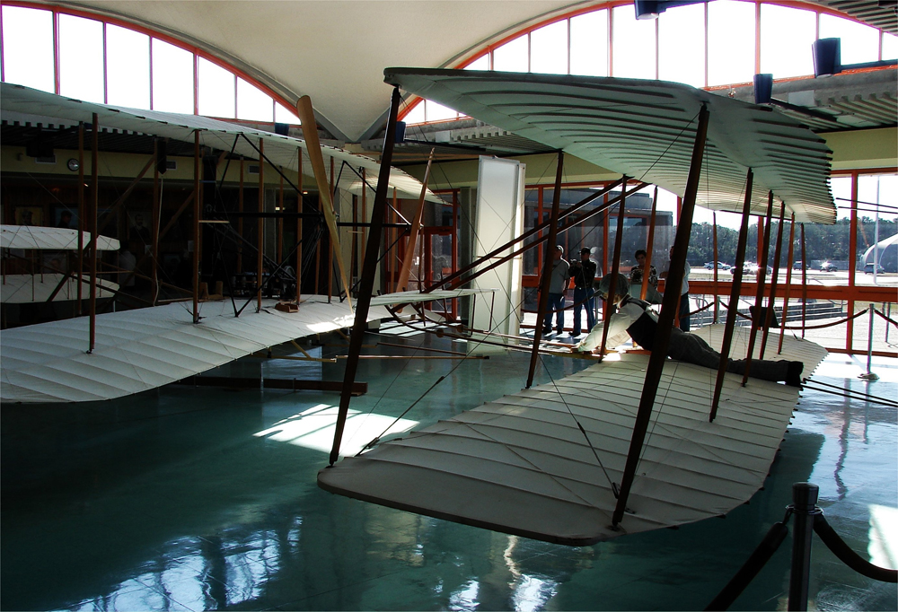
From atop the grounds that support the Wright Brothers Memorial, we look down upon the memorial grounds upon the two larger structures that house the various artifacts from that historic flight: Above. Inside the smaller structure are these two replicas of the planes that were the first to engage in manned flight by the Wright Brothers: Below. photos by Stan Deatherage Click the picture to expand to as much as 1000 pixels wide within most expanded images, and then push the arrows embedded in the center edge of the play-box to access the gallery, and slide new images into viewing within the center of the screen.
Tourism has been Dare County's main industry since the late-nineteenth century. The resorts, beaches, and historical sites attract many. Several museums and attractions in the region include the Cape Hatteras National Seashore, the Fort Raleigh National Historic Site, the North Carolina Aquarium, and the Pea Island National Wildlife Refuge.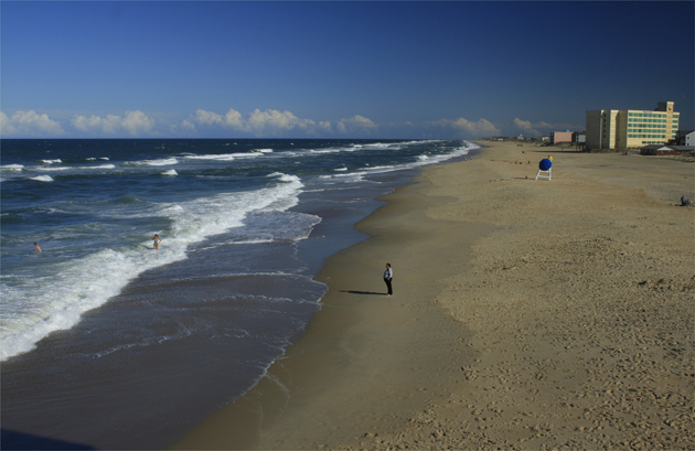
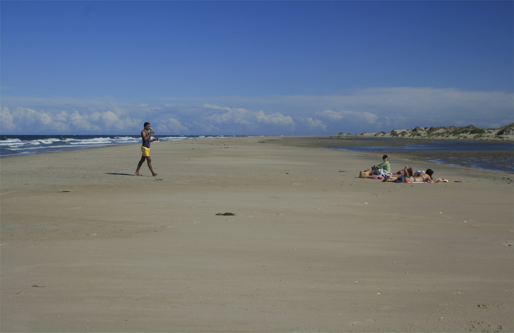
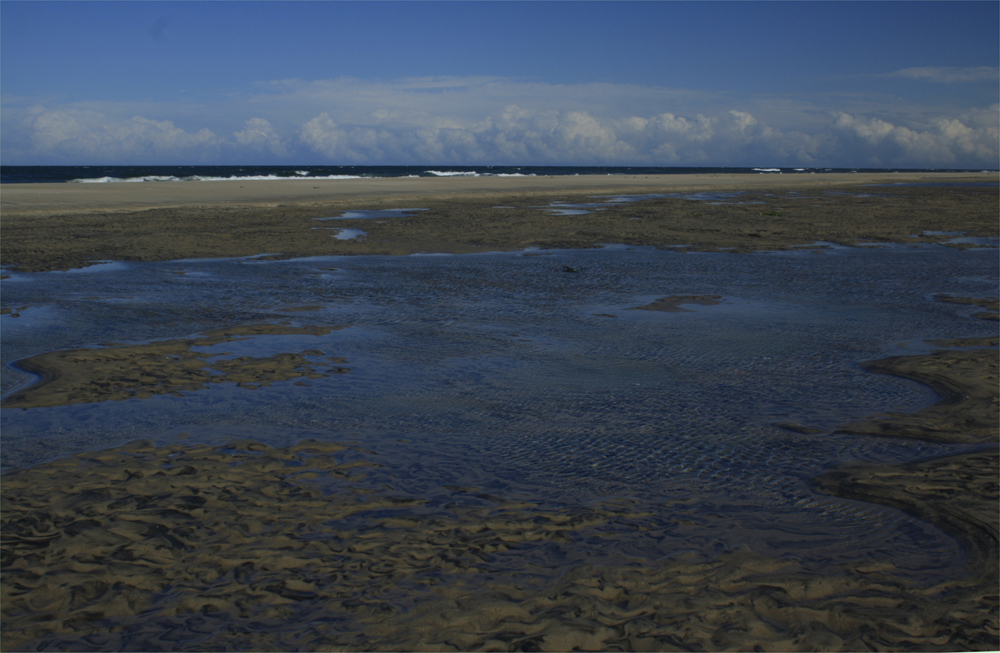
While there is an astounding amount of historical firsts, people still mostly come to Dare County for the sand and the surf. Here we see the surf along the shores of Nags Head from atop Jennette's Pier: Above. Oregon Inlet, just south of the long and winding Herbert C. Bonner Bridge, is the beginning one of the greatest swaths of unspoiled beach in eastern United States: Below and then again below. photos by Stan Deatherage Click the picture to expand to as much as 1000 pixels wide within most expanded images, and then push the arrows embedded in the center edge of the play-box to access the gallery, and slide new images into viewing within the center of the screen.


Sources:
NC Gen Web website, "History of Dare County" http://www.ncgenweb.us/dare/history.html, (accessed on June 30, 2011) and William S. Powell, ed., Encyclopedia of North Carolina (Chapel Hill, NC 2006)
Go Back
Dare County, one of North Carolina's coastal counties, has a rich history with national significance. Named for America's first English child, Virginia Dare, this northeastern county was originally part of the Tyrrell, Hyde, and Currituck Counties. In 1870, the North Carolina Legislature passed an act that separated Dare County to make transportation improvements as well as an increase in taxing procedures.
Manteo, the county seat, is named in honor of the Croatoan who helped the English establish the Roanoke Island Colony. Other communities within the county include Kitty Hawk, Nags Head, Wanchese, Kill Devil Hills, and Southern Shores. Also, Dare County has nearly 85 miles of uninterrupted coastline, and includes the famed Roanoke Island.

Formerly occupied by the Croatoan before English settlement, Dare County was the site of many colonization attempts. In the 1580s, Sir Walter Raleigh, the famous British adventurer and soldier, tried to establish a colony, in what he considered a New World, on Roanoke Island, but a lack of supplies doomed his efforts. After several years of isolation from the Old World, rescuers were unable to locate any colonists--of whom the whereabouts and fate are still an unsolved mystery.
The success of Wilbur and Orville Wright's first flight occurred in Dare County. Performing one of the most important events of the twentieth century, Orville Wright flew "The Flyer" 120 feet in 12 seconds on December 17, 1903, in Kill Devil Hills. Although several witnesses remarked at how anti-climatic the event was, the brothers attempted several more flights with the longest lasting nearly one minute and reaching a distance of 852 feet. The Wright Brothers National Memorial commemorates this accomplishment.
Tourism has been Dare County's main industry since the late-nineteenth century. The resorts, beaches, and historical sites attract many. Several museums and attractions in the region include the Cape Hatteras National Seashore, the Fort Raleigh National Historic Site, the North Carolina Aquarium, and the Pea Island National Wildlife Refuge.

Sources:
NC Gen Web website, "History of Dare County" http://www.ncgenweb.us/dare/history.html, (accessed on June 30, 2011) and William S. Powell, ed., Encyclopedia of North Carolina (Chapel Hill, NC 2006)

| New physician joins Vidant Family Medicine - Edenton | NC Past, In the Past, Body & Soul | Herbert C. Bonner (1891 - 1965) |


Home
Contact
About
Service Rates
Privacy Policy
Follow on Facebook
Subscribe to Newsletters
Rss Feed
Keywords
Eastern NC Now & ENC NOW © Copyright 1998-2024 All Rights Reserved.
